Cyclone Biparjoy at 910KM south of Karachi, to intensify further
The very strong cyclonic storm Biparjoy, which was over the east-central Arabian Sea for the past six hours, traveled approximately northward and was around 910 kilometers south of Karachi, according to the Met Office on Saturday. According to forecast reports, it is quite expected to intensify more and move north-northeastwards gradually during the next 24 […] The post Cyclone Biparjoy at 910KM south of Karachi, to intensify further appeared first on Economy.pk.
The very strong cyclonic storm Biparjoy, which was over the east-central Arabian Sea for the past six hours, traveled approximately northward and was around 910 kilometers south of Karachi, according to the Met Office on Saturday.
According to forecast reports, it is quite expected to intensify more and move north-northeastwards gradually during the next 24 hours. During the next three days, the storm is expected to move progressively north-northwestward.
Rain-thunderstorm with some heavy falls and squally winds is likely on the Sindh-Makran coast from 13 June night/to 14 June morning due to its probable north-northeast course.
According to the Pakistan Meteorological Department’s Saturday update, the very severe cyclonic storm over the east-central Arabian Sea has maintained its intensity and has traveled northeastward over the last 12 hours. According to PMD, the storm is located approximately 910 kilometers south of Karachi, 890 kilometres south of Thatta, and 990 kilometers southeast of Ormara.
Around the system centre, maximum sustained surface winds are 120-130 km/h with gusts up to 150 km/h. The favorable environmental circumstances help the system to intensify even further. The uncertainty in global models’ forecast of cyclone Biparjoy’s route remains due to shifts in upper-level steering winds, with some pointing to the Oman-Makran coast and others pointing to the Gujarat-Sindh coast.
Given this uncertainty, the system is expected to continue heading north/northeastward for the next 18-24 hours before recurving slightly to the north-northwest. PMD’s cyclone warning centre in Karachi is monitoring the situation and will issue updates as needed.
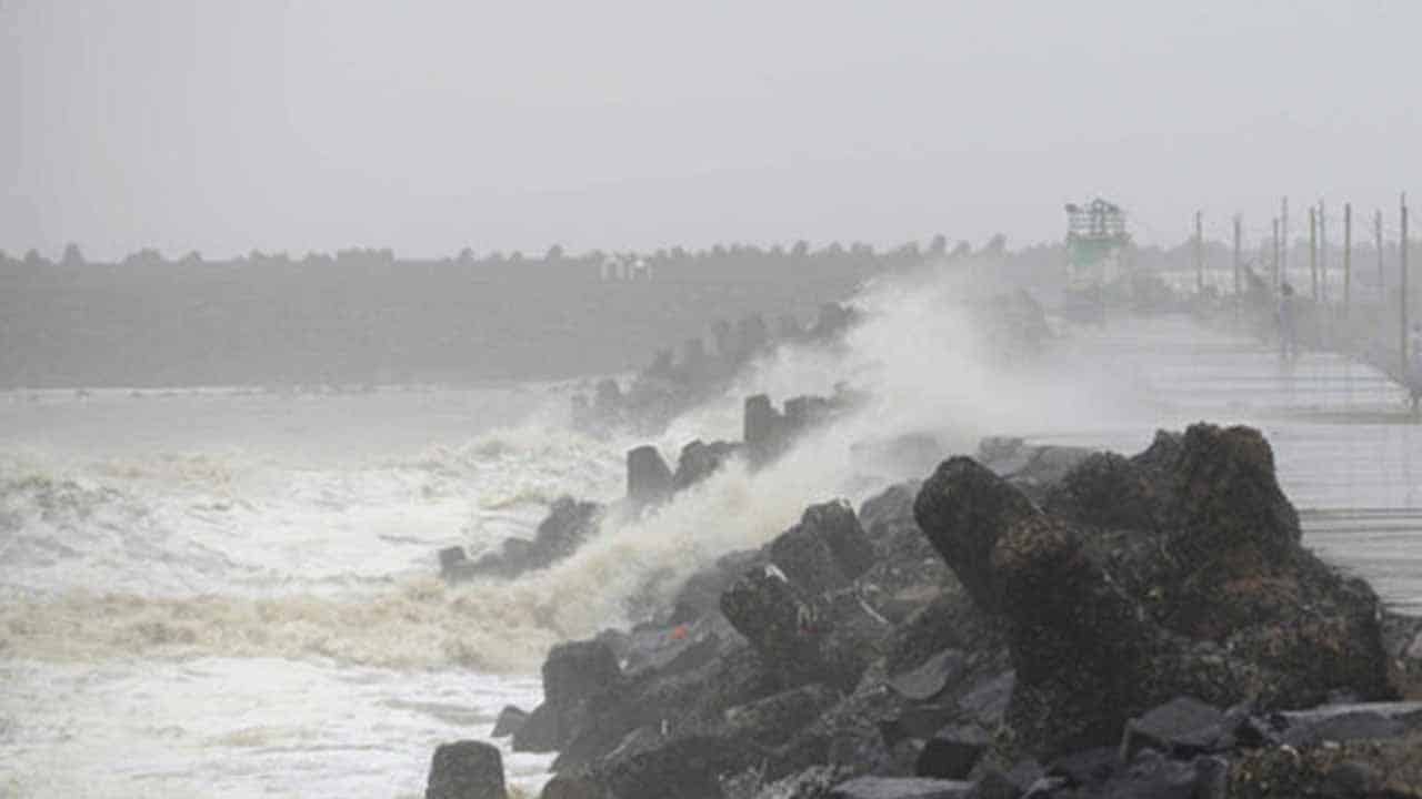
Fishermen have been cautioned not to venture out into the open sea until the system has passed, as the Arabian Sea conditions may get quite rough/high, with high tides around the shore.
From Tuesday night/Wednesday morning, a rain-thunderstorm with some heavy rains and violent gusts is forecast along the Sindh-Makran coast. Winds of high intensity can cause damage to loose and fragile structures.
The seas are rough at the system’s centre, with maximum wave heights of 25-28 feet.
The Indian weather service stated in an update Saturday morning that Cyclone Biparjoy was centred approximately 700 kilometers west of Goa, 630 kilometers west-southwest of Mumbai, 620 kilometers south-southwest of Porbandar, and 930 kilometers south of Karachi.
The post Cyclone Biparjoy at 910KM south of Karachi, to intensify further appeared first on Economy.pk.